
Gasherbrum I Expedition 8,080 m
- 48 days, Islamabad to Islamabad
- 8,080 m — Hidden Peak
- The hard one of the two Gasherbrums
- Small teams, self-led above base camp
- Baltoro, Concordia and the Abruzzi Glacier
- Hotels either end, tents between
- Mid-June to early August
- 48-day itinerary
About this tour
Gasherbrum I is the eleventh-highest mountain on earth at 8,080 metres, the highest of the Gasherbrum group, and the one nobody sees from the Baltoro. That is how it got the name Martin Conway's 1892 survey gave it: Hidden Peak, set so far back behind the ridges at the head of the glacier that you walk for a week without a glimpse of it and then it is suddenly in front of you. The Balti name is kinder — from rgasha, beautiful, and brum, mountain.
It shares a base camp with Gasherbrum II and almost nothing else. G-II is the reasonable first 8,000er: long, high, and mostly a question of patience on moderate angles. G-I is the hard one of the pair. The route steepens exactly where it matters, high on the mountain and late in the day, the traffic is a fraction of its neighbour's, and it carries one of the higher fatality-to-summit ratios among the fourteen. If you are choosing between the two Gasherbrums, choose honestly. We will ask about your climbing history before we take a deposit, and we would rather have that conversation now than at Concordia.
The mountain has a serious history and it is worth knowing what you are joining. The first ascent was made on 5 July 1958 by Pete Schoening and Andy Kauffman, on Nick Clinch's expedition — the only 8,000-metre peak whose first ascent was made by Americans. In 1975 Reinhold Messner and Peter Habeler climbed a new line on the north-west face with no fixed camps, no porters above base camp and no oxygen, which was the first time any 8,000er had been done in genuine alpine style and remains one of the most consequential climbs in Karakoram history. The first winter ascent waited until March 2012, when Adam Bielecki and Janusz Gołąb reached the summit.
The route most teams climb today starts from the South Gasherbrum Glacier and works up through the icefall towards the Gasherbrum La, with camps at roughly 5,900, 6,400 and 7,000 metres, before the Japanese Couloir takes the line up onto the ground the 1958 Americans climbed at around 7,500 metres. Teams vary the placements and some split the upper camps differently. What does not vary is the character of it: an objectively dangerous icefall low down that you cross many times on rotations, a col that funnels weather, and a summit day that is long and steep and unforgiving of a party moving slowly.
The approach is the classic one, and one of the great walks anywhere on earth. By jeep from Skardu up the Braldu gorge to Jhola, then a week on foot — Paiyu, Urdukas, Goro II — to Concordia, where the Baltoro, Godwin-Austen and Abruzzi glaciers meet beneath K2 and Broad Peak, and finally up the Abruzzi to base camp at 5,100 metres. Seven days from 2,228 metres to 5,100 with a rest day at Urdukas, which is a sound acclimatisation profile and is not one to compress. Then thirty days are given to the mountain: rotations, recovery, and the waiting that all Karakoram climbing comes down to.
What we provide is everything to base camp and nothing above it. Permits and royalty, park and waste fees, the liaison officer, porters, transport, a licensed guide as the permit requires, cargo handling in Skardu, and a serviced base camp with cook, dining, shower and toilet tents, generator and satellite phone. The climbing above base camp is your team's own unless you ask us to quote for high-altitude porters, fixed rope, high camps or oxygen — and on this peak, unlike on G-II, the level of support you choose changes the odds enough that it should be decided deliberately rather than by default.
Thirty days sounds generous until you have sat through a Karakoram August. The range is less settled than the Nepal Himalaya, a workable window may be short, may come late, or may not arrive at all, and teams do go home without a summit. That is the trip. Anyone selling you a 30-day Hidden Peak with a high success rate is selling you a schedule the mountain has not agreed to.
Trip highlights
The eleventh-highest mountain on earth
8,080 metres, the highest of the Gasherbrum group, and hidden from the Baltoro until the last hour of the walk in — which is exactly what Conway's survey named it for in 1892.
The Japanese Couloir and the 1958 line
Up through the South Gasherbrum icefall towards the Gasherbrum La, camps at roughly 5,900, 6,400 and 7,000 m, then the couloir onto the ground Schoening and Kauffman climbed on the first ascent at around 7,500 m.
Ten days up the Baltoro to get there
Jhola, Paiyu, Urdukas and Goro II to Concordia, under the Trango Towers, Muztagh Tower, Masherbrum and Gasherbrum IV, with K2 and Broad Peak at the junction. The finest approach march of any 8,000er anywhere.
Thirty days on the mountain
Rotations, recovery and the waiting. The Karakoram gives shorter and less reliable windows than the Nepal Himalaya, and a schedule with no slack in it is a schedule that goes home early.
Everything to base camp, arranged by the licence holder
Permit and royalty, park and waste fees, liaison officer, porters, a licensed guide, cargo handling in Skardu, and a serviced camp with cook, generator and satellite phone. We hold the licence rather than broker it.
A climber's peak, not a queue
Hidden Peak sees a fraction of the traffic its neighbour does. There is no conga line, no fixed rope laid by somebody else, and no crowd to follow. That is the appeal, and it is also the reason the team on the rope matters more here.
Route
- 1 Start
- 2 Stop in order
- 7 Finish
- Route travelled
Loading map…
At a glance
- 48 days, Islamabad to IslamabadTen days in on the Baltoro, thirty on the mountain, and a week to get out and home.
- 8,080 m — Hidden PeakThe eleventh-highest mountain on earth, and the highest of the Gasherbrum group.
- The hard one of the two GasherbrumsSteeper, longer and more committing than G-II, with a fraction of the ascents. Not a first 8,000er.
- Small teams, self-led above base campFull logistics and a licensed guide to base camp. High-altitude support and oxygen quoted separately.
- Baltoro, Concordia and the Abruzzi GlacierJhola, Paiyu, Urdukas, Goro II and Concordia, then base camp at 5,100 m shared with G-II.
- Hotels either end, tents betweenIslamabad, Chilas and Skardu in hotels; dome tents on the trek and a serviced base camp.
- Mid-June to early AugustOne summer season. Cargo and permits are arranged months ahead, so book early.
Day by day
Day 1Arrival in Islamabad

Your guide meets you at the airport and transfers you to the hotel at 540 metres. There is time for the capital if your flight lands early: the Faisal Mosque beneath the Margalla Hills, the terraces of Shakarparian, the Pakistan Monument and the Lok Virsa museum. In the evening we run the expedition briefing, go through insurance and documentation, and eat together.
Day 2Islamabad to Chilas over the Babusar Pass

Six or seven hours and 239 kilometres north through the Kaghan Valley to Naran, then three or four more over the Babusar Pass at 4,173 metres and down 113 kilometres to Chilas at 1,265 metres. We stop at the top of the pass for as long as anyone wants. Driving rather than flying in is deliberate: this is a free 4,000 metres on day two, and your body will use it.
Day 3Chilas to Skardu along the Indus

Eight or nine hours and 290 kilometres east with the Indus below and bare walls thousands of metres above it. We stop where the Karakoram, the Himalaya and the Hindu Kush meet within sight of each other — there is nowhere else on earth you can say that — and again for the view of Nanga Parbat, 8,126 metres, standing entirely clear of its neighbours. Skardu at 2,228 metres is the staging town for the whole range.
Day 4Jeep up the Braldu gorge to Jhola
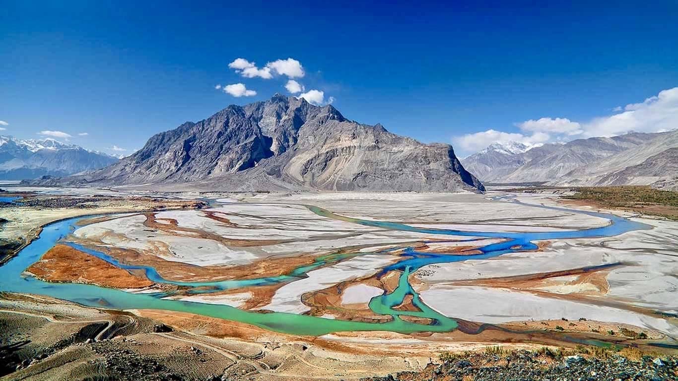
Eight or nine hours by jeep through the Shigar valley and into the Braldu, on a track that fords the river three times and spends the rest of the day cut into the side of the gorge. Askoli is the last village in the Karakoram and the place every Gasherbrum expedition weighs its loads: this is where the porter train forms up, where the cargo is divided into 25 kg loads, and where the liaison officer's paperwork is checked before anyone walks. Camp at Jhola, 3,100 metres, in twin-sharing dome tents on the sand above the river.
Day 5Jhola to Paiyu — the snout of the Baltoro

Six or seven hours and 16.6 kilometres of undulating trail above the Braldu, hard in places and hot for most of it. The gorge finally opens onto the grey snout of the Baltoro glacier, and the skyline ahead becomes the one the range is famous for: Cathedral Peak, the Trango group and, if the air is clear for half an hour, the tip of K2. Paiyu at 3,450 metres is the last stand of trees before the ice. The porters bake two days of bread here for the glacier, and the smell of it is the thing everyone remembers about this camp.
Day 6Paiyu to Urdukas — onto the glacier

Seven or eight hours and 15.9 kilometres, and the day the walking changes character entirely. You step onto the Baltoro and the trail stops being a trail: it becomes the endless rise and fall of moraine, boulders balanced on ice, and a line that is different from one season to the next because the glacier moves. Paiyu Peak at 6,610 metres, Uli Biaho at 6,417 and Trango Tower at 6,286 stand over the whole day. Urdukas at 4,050 metres is a grassy shelf a hundred metres above the ice — the last vegetation of the walk in, and worth every step of the climb up to it.
Day 7Urdukas — acclimatisation day at 4,050 m

A rest day, and the most valuable one on the walk in. There is a short climb up the slope behind camp for a few hundred metres of height, taken slowly and given back before evening; otherwise this is a day for drinking more than you want to and watching the light move across the Trango group all afternoon. The porters cook their own food and the evening is a sociable one. Compressing this day to save a night is the most common mistake made on the Baltoro, and expeditions pay for it above Goro rather than here.
Day 8Urdukas to Goro II — camping on the ice

Five or six hours and 12.1 kilometres out along the medial moraine into the middle of the glacier, and the day the giants arrive in full. Masherbrum at 7,821 metres holds the southern skyline, Muztagh Tower at 7,284 comes into view ahead, and Gasherbrum IV at 7,925 begins to close the head of the valley — the peak that dominates every photograph of Concordia and is not even the highest of its own group. Camp at Goro II, 4,380 metres, pitched on the ice itself. The cold arrives the moment the sun leaves the valley, which on the Baltoro is early.
Day 9Goro II to Concordia

Five or six hours and 9.2 kilometres to Concordia at 4,650 metres, where the Baltoro, Godwin-Austen and Abruzzi glaciers meet and the whole amphitheatre opens at once: K2 at 8,611 metres straight up the northern branch, Broad Peak at 8,051 beside it, Gasherbrum IV closing the valley, Mitre Peak and Sia Kangri around the rim. Three hundred and sixty degrees of it, and no photograph has ever done it justice. Almost everyone stays out in the cold longer than is sensible and nobody has ever regretted it. Hidden Peak, note, is still not visible from here.
Day 10Concordia to Gasherbrum Base Camp, 5,100 m

Five or six hours south-east up the Abruzzi glacier under the Gasherbrum wall to base camp at 5,100 metres, the shared ground for the Gasherbrum I and Gasherbrum II teams. Hidden Peak, which has stayed out of sight behind the ridges for the entire walk in, finally shows itself in the last hour — and the surveyors' name for it makes complete sense the moment it does. The camp goes up properly today: sleeping tents, dining tent, toilet and shower tents, store, kitchen and generator. This is home for the next month.
Days 11–40Thirty days on Hidden Peak — rotations, the Gasherbrum La and the summit window

The climbing period, worked in rotations rather than one push. The line is prepared and the camps stocked, loads are carried, and you sleep progressively higher and drop back to base camp to recover between cycles — a pattern most teams repeat two or three times before anyone thinks about the top.
The ground itself: out of base camp and into the South Gasherbrum icefall, which is the objective hazard of this mountain and which you will cross more times than you would like. Camp 1 at around 5,900 metres, then the climb towards the Gasherbrum La for Camp 2 near 6,400, on a col that funnels every weather system that comes through. Camp 3 at roughly 7,000 metres. From there the Japanese Couloir leads onto the upper mountain and joins the line the 1958 American party climbed at about 7,500 metres, and the summit day from Camp 3 is long, steep near the top, and thoroughly unforgiving of a party that is moving slowly.
This is where Hidden Peak separates from its neighbour. Gasherbrum II is a long climb at moderate angles that rewards patience; Gasherbrum I steepens exactly where fatigue and altitude are already doing their work. Acclimatisation earned properly in the first fortnight is the currency you spend up there, and there is no way to borrow it later.
Then the wait, which is most of what expedition climbing in the Karakoram actually is. The range is less settled than the Nepal Himalaya, a workable window may be short, may come late, or may never arrive. Thirty days covers the rotations, the recovery and the sitting, and teams do go home without a summit. Base camp service runs throughout — cooked meals, hot water, the generator, the satellite phone — and everything above base camp is the team's own unless high-altitude support or oxygen was arranged before you left Islamabad.
Days 41–44Down the Baltoro to Jhola

Four days retracing the approach at about twice the pace — base camp to Concordia, then Goro II, Urdukas or Paiyu, and Jhola. Camp comes down behind us and the porters carry everything out, waste included, which is a condition of the park permit and is checked. Going down is easy on the lungs and brutal on the knees. Each day the air thickens and the temperature climbs, and somewhere below Paiyu there is grass again and the smell of vegetation after five weeks of rock and ice is genuinely startling.
Day 45Jhola to Skardu by jeep

Eight or nine hours back down the Braldu gorge and out through Shigar to Skardu at 2,228 metres. A hotel, a hot shower and a proper meal at the end of it, all three of which take on a significance that is difficult to explain to anyone who has not just come off a glacier. Cargo left in the Skardu store is collected and sorted this evening, and the official debriefing with the Ministry is arranged around it.
Day 46Fly Skardu to Islamabad

The morning flight back over the mountains — forty minutes, Nanga Parbat off the wing, and the whole approach you just walked laid out below in about ninety seconds. Down to 540 metres and a hotel with a laundry service. Entirely weather-dependent: if the flight is cancelled we drive, nine hours or so by way of Chilas, which is exactly what tomorrow is held in reserve for.
Day 47Free day in Islamabad, or the drive if the flight did not go

Free if yesterday's flight operated, and the fallback if it did not — in which case it is eleven or twelve hours on the road over the Babusar Pass instead, and you will be glad the day was held. Otherwise: paperwork and the debriefing in the morning, then the Faisal Mosque, the Pakistan Monument, the lanes of Saidpur, shopping for anyone who has promised gifts, or a long farewell dinner up at the Monal with the city spread out below.
Day 48Departure from Islamabad

Breakfast and a transfer to the airport for your international flight. A day room, extra nights or an onward extension are easy to arrange if your schedule allows — Lahore is two hours south and worth a couple of days on its own, and anyone who has just spent a month at 5,100 metres tends to find the Punjab in August a shock worth experiencing.
What’s included
- Government climbing permit for Gasherbrum I, the royalty, and all associated paperwork
- Central Karakoram National Park entry, camping, bridge and waste management fees
- Ministry of Tourism liaison, and the official briefing and debriefing arrangements
- Liaison officer's wages and equipment allowance
- Licensed professional mountain guide, as the permit requires
- Hotel accommodation in Islamabad, Chilas and Skardu, twin-sharing
- All camping on the trek and at base camp — sleeping, dining, toilet, shower and store tents
- All meals from arrival in Islamabad to departure
- Cook, kitchen staff and expedition support crew
- Kitchen equipment, fuel and shared community gear
- Porters for all expedition loads to and from base camp
- Cargo handling and secure storage in Skardu
- All domestic flights and road transfers, including the jeep sections
- Electricity generator at base camp
- Satellite phone for emergencies and a base-camp first aid kit
Not included
- International airfare and airport taxes
- Pakistan visa and personal travel, medical and evacuation insurance
- Any service above base camp — high-altitude porters, a personal climbing Sherpa, fixed rope, high camps and oxygen are quoted separately
- Personal climbing equipment, clothing and sleeping bag
- Single room supplements in the hotels
- Individual airport transfers outside the group arrangements
- Optional excursions or changes to the itinerary
- Personal expenses — drinks, phone charges, laundry and room service
- Tips for drivers, porters, guides and base-camp staff
Good to know
Gasherbrum I is not the approachable Gasherbrum
Do not book this peak because you have read that the Gasherbrums are the friendly 8,000ers. That is true of G-II and it is not true of Hidden Peak. This one is steeper, longer and considerably more committing, it sees a fraction of the traffic, and the ground high on the mountain rewards technical competence rather than patience alone. We will ask about your climbing history and we would rather have that conversation before a deposit than at Concordia.
What we need to know about your climbing
Previous experience at 8,000 metres is strongly recommended and most teams on this mountain have it. Failing that, we want to see at least one high 7,000er, solid technical competence on steep snow and ice, experience of moving roped on glaciers and in an icefall, and the self-sufficiency to make your own decisions in bad weather at altitude. Send us a climbing CV rather than a summary. It is not a formality and it is not a sales filter — on a peak with this little traffic, the composition of the rope is the safety system.
Everything to base camp, and nothing above it
The price covers the permit and royalty, park and waste fees, the liaison officer, hotels, the full walk in and out, porters, and a serviced base camp with dining, shower and toilet tents, a cook, a generator and a satellite phone. It does not cover high camps, fixed rope above base camp, high-altitude porters or supplementary oxygen. Those are separate lines on the quotation, and on this route the level of support you choose affects the outcome more than it does on G-II. Decide it deliberately and tell us at the enquiry stage rather than in June.
The permit has a statutory lead time
Pakistan requires the climbing permit application at least 55 days before arrival, with passport copies and photographs, and a licensed operator has to apply on your behalf — an individual cannot. The royalty is set by the government per team and is a significant part of any quotation; we pass it through at cost and show it as its own line. Cargo, porters and food are arranged months ahead. A team assembled in a hurry is a worse team, and it is also a team that may simply not get a permit in time.
Insurance that actually covers this
Not included, and required. It must cover the maximum altitude on your itinerary — 8,080 metres, not 6,000 — and include helicopter evacuation and repatriation. We may ask to see the policy before departure. A helicopter off the Baltoro is arranged through the military, needs a guarantee of payment before it lifts, and costs what it costs; a policy with an altitude exclusion buried in it is worth nothing on the day it is needed.
How the acclimatisation is built
The height is gained steadily: 540 metres in Islamabad, over the Babusar Pass at 4,173 on day two, 1,265 at Chilas, 2,228 at Skardu, then seven days on foot to 5,100 with a rest day at Urdukas. That profile is the reason we drive in rather than fly — the pass is free altitude on day two — and the reason the walk in is not compressed. Nearly every problem we see on the Baltoro starts with someone arriving fit, feeling strong on day three, and paying for it above Goro.
Weather, windows and going home empty-handed
The Karakoram is less settled than the Nepal Himalaya and its summit windows are shorter — a matter of days, sometimes hours. Thirty days on the mountain is what makes an attempt realistic rather than decorative, and it is still not a guarantee. Teams go home without a summit, on this peak more often than on most. If a high success rate is what you are buying, buy a different mountain, and be suspicious of anyone who quotes you one for Hidden Peak.
Getting out, and leaving slack in your flights
We drive in over Babusar and fly out of Skardu. The drive is long and not weather-dependent; the flight is entirely weather-dependent, which is why a spare day sits at the end of the programme. Leave slack in your onward international booking — the fallback is a nine-hour drive, and after a month at altitude nobody wants to do it against a clock.
If you want both Gasherbrums
There is a 55-day double-header that puts G-II and G-I in one season from the same base camp. Climbing the easier peak first is the sensible order, it is how most successful pairs are done, and the acclimatisation from the first attempt is what makes the second realistic. Ask for that itinerary rather than trying to bolt a second peak onto this one late.
Questions about this trip
How hard is Gasherbrum I compared with Gasherbrum II?
Harder by a clear margin, and the difference is not marginal enough to gamble on. Gasherbrum II is a long climb on moderate angles that mostly asks for patience, good acclimatisation and a settled window; it is a reasonable first 8,000er and thousands of climbers have treated it as one. Gasherbrum I is steeper where it matters, more committing, sees a fraction of the traffic, and carries one of the higher fatality-to-summit ratios among the fourteen 8,000ers. Climbers who found G-II comfortable are the right candidates for this one. Climbers who found G-II at their limit are not, and we will say so.
What route does the expedition climb?
From base camp on the South Gasherbrum glacier the route works up through the icefall towards the Gasherbrum La, with camps at roughly 5,900, 6,400 and 7,000 metres, then takes the Japanese Couloir onto the upper mountain and joins the line of the 1958 American first ascent at about 7,500 metres. Teams vary the camp placements and some split the upper mountain differently. The three fixed characteristics are the icefall low down, which is the main objective hazard and which you cross repeatedly on rotations; the col, which funnels weather; and a long, steep summit day from Camp 3.
How much does a Gasherbrum I expedition cost?
Quoted per team rather than published, because the two largest components both depend on your group. The government royalty for an 8,000-metre permit is charged per expedition with a set team size, so the cost per climber falls sharply as the rope grows; and the support you choose above base camp — high-altitude porters, fixed rope, stocked high camps, oxygen — can be a larger line than everything below base camp put together. What our figure always covers is the same list: permit and royalty, park and waste fees, liaison officer, hotels, transport, porters, the licensed guide and a fully serviced base camp. Send us your team size, your dates and the support you want, and the quotation comes back itemised.
Do I need previous 8,000 metre experience?
Strongly recommended, and in practice most people on this mountain have it. Without it we would want to see a high 7,000er, real competence on steep snow and ice, glacier and icefall experience, and the judgement to turn round in bad weather without being told. Send a climbing CV when you enquire. We are a licensed operator rather than a guiding service on this peak — above base camp the climbing is your team's — so who you are and who you are climbing with is the safety system, not an administrative detail.
How long is the expedition, and why 48 days?
Forty-eight days, Islamabad to Islamabad. Roughly ten of those are the drive and the walk in up the Baltoro, thirty are the mountain, and the rest is getting out and home with a weather day held at the end for the Skardu flight. The thirty is the part that matters: it covers two or three acclimatisation rotations, recovery between them, and the waiting for a window that may be short or may not come. A shorter programme on Hidden Peak is a cheaper way to not summit.
What is the summit success rate on Hidden Peak?
Lower than on Gasherbrum II and lower than most commercially climbed 8,000ers, and any operator who gives you a confident percentage for a peak with this little annual traffic is inventing it. The honest version: in a good season with a settled window a competent, well-acclimatised team has a real chance; in a poor season nobody on the mountain summits. We plan for thirty days on the peak precisely because that is the difference between an attempt and a gesture, and we would rather you budget your expectations the same way.
Who first climbed Gasherbrum I?
Pete Schoening and Andy Kauffman, on 5 July 1958, as part of an eight-man American expedition led by Nick Clinch — the only 8,000-metre peak whose first ascent was made by Americans. In 1975 Reinhold Messner and Peter Habeler climbed a new line on the north-west face with no fixed camps, no high-altitude porters and no oxygen, the first time an 8,000er had been climbed in true alpine style. The first winter ascent came much later, in March 2012, by the Poles Adam Bielecki and Janusz Gołąb.
What does the price include, and what is extra?
Everything to base camp: the permit and royalty, Central Karakoram National Park entry, camping, bridge and waste fees, the liaison officer, the licensed guide the permit requires, hotels in Islamabad, Chilas and Skardu, all transport including the jeeps, porters for every expedition load, cargo handling in Skardu, all meals, and a serviced base camp with cook, dining, shower and toilet tents, generator and satellite phone. Extra: anything above base camp, personal equipment, insurance, the visa, international flights and tips. That split is deliberate and we state it plainly rather than bury it.
Can you arrange high-altitude porters, oxygen or a personal Sherpa?
Yes, all of it, quoted separately — high-altitude porters, stocked high camps, fixed rope above base camp, supplementary oxygen and a personal climbing Sherpa. On Gasherbrum I this decision matters more than on its neighbour, because the upper route is steeper and a party that is slow at 7,500 metres has fewer good options. Tell us what you want at the enquiry stage. Adding support in June, when cargo is already moving and staff are already committed, is either impossible or expensive, and usually both.
How does the climbing permit work?
The Pakistani government requires the application at least 55 days before you arrive, with passport copies and photographs, and it must be filed by a licensed operator — an individual climber cannot apply. A liaison officer is assigned to the expedition and their wages and equipment allowance are part of the cost, which is why they appear in the inclusions. There is an official briefing before the expedition and a debriefing afterwards, both of which we arrange. We hold the licence ourselves rather than brokering the permit through a third party.
What insurance do I need?
A policy that explicitly covers climbing to 8,080 metres, plus helicopter evacuation and repatriation. This is not the place for a general travel policy: most of them exclude mountaineering above a few thousand metres, and an altitude exclusion is worth finding in April rather than on the glacier. We may ask to see the policy before departure. A helicopter off the Baltoro is arranged through the military and needs a guarantee of payment before it lifts.
When does Gasherbrum I run, and can it be climbed in winter?
Mid-June to early August, which is the Karakoram's single summer season, and the expedition dates are set within it. Winter ascents exist — the first was in March 2012 — but they are the province of small, self-contained, extremely experienced teams, and we do not run a commercial winter programme on this peak. If you are planning a winter attempt and need a licensed operator for the permit and logistics, that is a different conversation and we are happy to have it.
Can I climb both Gasherbrums in one season?
Yes, and it is the most efficient way to do it, because both peaks share the same base camp, the same permit season and the same walk in. We run a 55-day double-header for exactly this, with G-II climbed first — the easier peak first is the sensible order, and the acclimatisation banked on it is what makes the second attempt realistic. What does not work is deciding at base camp in July to add a second 8,000er, since the permit and royalty are peak-specific and cannot be extended on the spot.
How fit do I need to be, and how do I train for it?
Fit enough to carry 20 kilos for eight hours a day for a week on moraine before the climbing even starts, and then to repeat rotations above 6,000 metres for a month. In practice that means a year of structured endurance work, long days with a loaded pack in real terrain, and a level of hill fitness that does not depend on being fresh. The specific attribute Hidden Peak asks for is the ability to keep moving competently on steep ground when you are already tired and already high — which is trained on mountains, not in a gym.
Explore the region

You might also consider
 Nanga Parbat Rupal Face 8,126 mThe Rupal face — 4,600 metres of mountain in one wall, and the biggest objective in Pakistan.Price on request
 Gasherbrum I & II Double HeaderTwo 8,000 m summits from one base camp — Gasherbrum II first, then Hidden Peak, in a single season.Price on request
 K2 & Broad Peak Double HeaderBroad Peak and K2 in one Karakoram season, from neighbouring camps on the Godwin-Austen.Price on request
Enquire about this trip
Tell us who is travelling and roughly when. A trip planner — not a call centre — replies within three hours between 9am and 11pm Pakistan time with a day-by-day itinerary and the full price, per person, with nothing hidden underneath it.
- Every itinerary written from scratch around your dates.
- Licensed operator, running these routes since 2014.
- A full costing up front — no deposit to see one.
- +92 310 5344471
- info@elhamasia.com
- 9am – 11pm PKT, seven days a week
- Office No. 227, Rohtas Road, G-9/1, Islamabad, Pakistan


