Afghan Wakhan Corridor & Hindu Kush Expedition
- 12 days, Khorog to Khorog
- Max altitude 4,300 m (high pass beyond Sarhad)
- Best season June to September
- Four to eight travellers
- Wakhan, Badakhshan, Afghanistan
- Read the safety section first
- 12-day itinerary
About this tour
Start with the first section of Good to know, because it decides whether this trip is for you at all. Most Western governments, including the UK, the US and Australia, advise against all travel to Afghanistan. Standard travel insurance does not apply, the de facto authorities require a visa, permits and registration, and departures can be cancelled at short notice. In the Wakhan you are also several days' travel from a hospital.
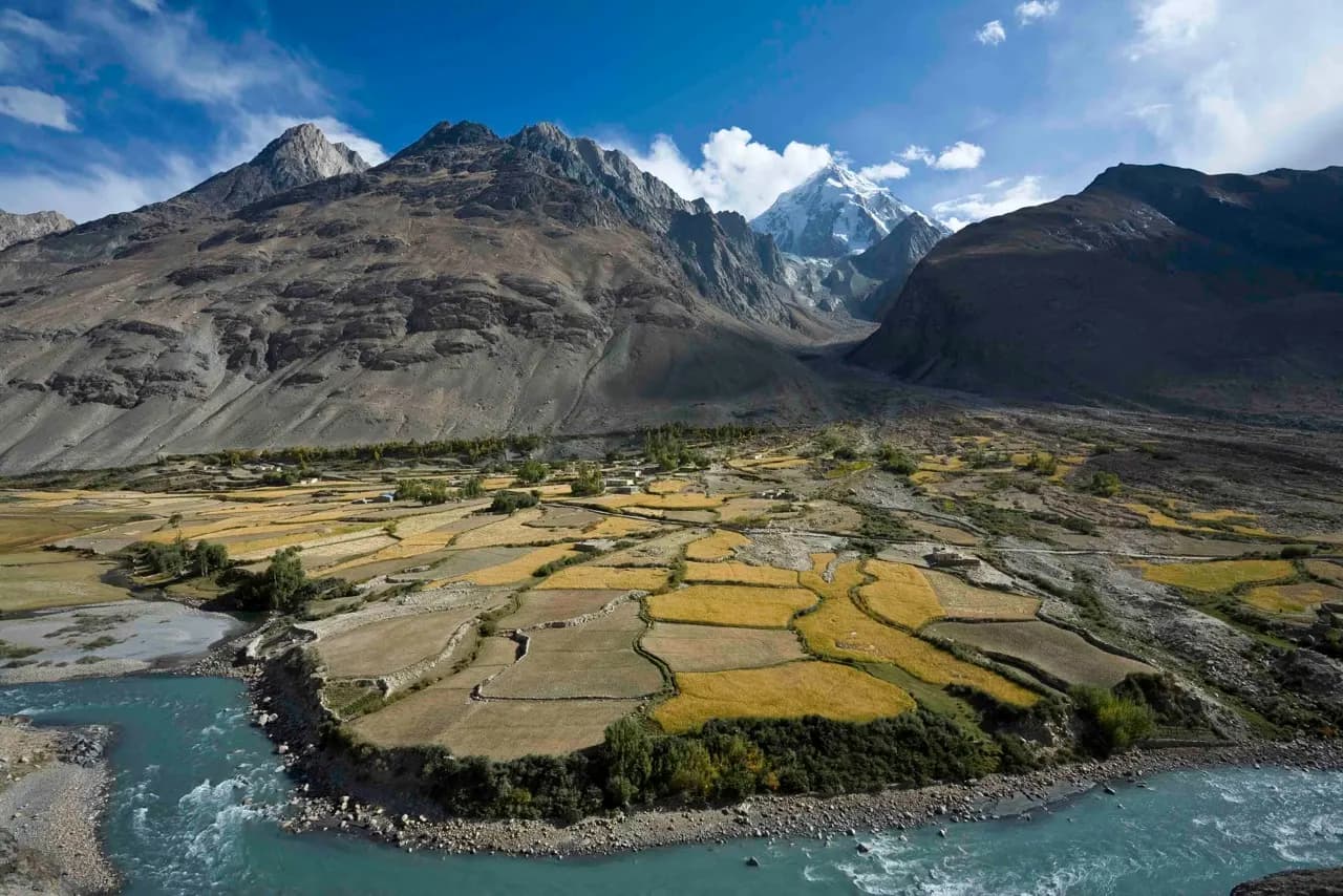
The Wakhan Corridor is the long, thin finger of north-eastern Afghanistan drawn in the nineteenth century as a buffer between the Russian and British empires. It runs some 300 kilometres east from Ishkashim, with Tajikistan across the Panj river to the north, Pakistan behind the Hindu Kush to the south and China at its far end. The people of the lower valley are Wakhi, Ismaili farmers growing barley and keeping yaks; at its eastern end, in the Little and Big Pamirs at around 4,000 metres, live the Afghan Kyrgyz, among the most isolated communities in Asia.
The usual way in is from Tajikistan, over the bridge at Ishkashim, and that is how this itinerary works: it starts and ends in Khorog. From Ishkashim the track runs up the Wakhan by four-wheel drive past Khandud and Qala-e Panja, where the Wakhan and Pamir rivers meet to form the Panj, to the road-head at Sarhad-e Broghil at about 3,300 metres. From Sarhad you walk with pack animals and Wakhi herders up into the summer pastures and over a pass of about 4,300 metres towards the western edge of the Little Pamir.
We want to be exact about what twelve days can do. The main Kyrgyz camps of the Little Pamir, around Bozai Gumbaz and Lake Chaqmaqtin, are five or six days' walk beyond Sarhad, and the round trip alone needs longer than this whole itinerary. This trek reaches the high Wakhi pastures and the western margin of the Little Pamir; whether you meet Kyrgyz herders there depends on where they are grazing that summer. If reaching the Kyrgyz camps is the point of your trip, ask us about a longer version.
This is a new itinerary. We have not run it before, and every departure is confirmed only after the advisories, the border crossing at Ishkashim and the permit position have been checked for that season.
Trip highlights
The Wakhan Corridor, overland and on foot
Three days up the valley by four-wheel drive from Ishkashim to the road-head at Sarhad-e Broghil, then five days walking with pack animals into the high pastures. Few places in Asia are as far from a paved road.
Wakhi villages and high summer camps — and the edge of the Kyrgyz Pamir
You stay in Wakhi homes and guesthouses along the valley and walk to the herders' summer camps above Sarhad. The Afghan Kyrgyz graze the Little Pamir further east; meeting them on this itinerary depends on how far west they are that summer, and we will not promise it.
Views of Noshaq and the high Hindu Kush
Noshaq, at 7,492 metres Afghanistan's highest mountain, stands above the lower Wakhan and can be seen up its side valley near Qazi Deh. The south side of the corridor is a continuous wall of the Hindu Kush, with the Pamirs of Tajikistan opposite.
Qala-e Panja and the Silk Road forts of the Panj valley
Qala-e Panja, the old seat of the Wakhan's rulers, stands where the Wakhan and Pamir rivers join to form the Panj. The better-known fortresses of Yamchun and Khaakha are on the Tajik bank of the river: they are seen, if at all, from across the water, and are not part of the Afghan route.
Route
- 1 Start
- 2 Stop in order
- 7 Finish
- Route travelled
Loading map…
At a glance
- 12 days, Khorog to KhorogFour days of four-wheel drive, five trekking days and the border crossing at Ishkashim both ways.
- Max altitude 4,300 m (high pass beyond Sarhad)Sarhad-e Broghil, the road-head, is about 3,300 m. Four nights camped between about 3,600 and 4,000 m.
- Best season June to SeptemberThe only months the high pastures are free of snow and the herders are up there.
- Four to eight travellersSmall by necessity: guesthouses are tiny and the trek runs on pack animals.
- Wakhan, Badakhshan, AfghanistanEntered from Khorog, Tajikistan: Ishkashim, Khandud, Qala-e Panja, Sarhad-e Broghil.
- Read the safety section firstAdvisories, specialist insurance, permits and the reality of evacuation from the Wakhan.
Day by day
Day 1Arrive Khorog, Tajikistan, 2,100 m
Meet in Khorog, the capital of Tajik Badakhshan on the Panj river. Document check for the border — Afghan visa, Tajik re-entry visa, GBAO permit, insurance — and a kit check for the trek. Overnight in a hotel in Khorog.
Day 2Drive to Ishkashim and cross into Afghanistan, 2,600 m
About two and a half hours south down the Panj on the Tajik side to Ishkashim, then the bridge across the river into Afghanistan. Border formalities on both sides take as long as they take; allow most of the morning. Registration with the local authorities in Afghan Ishkashim, then the evening in the town. Overnight in a guesthouse.
Day 3Up the Wakhan to Qala-e Panja, 2,800 m
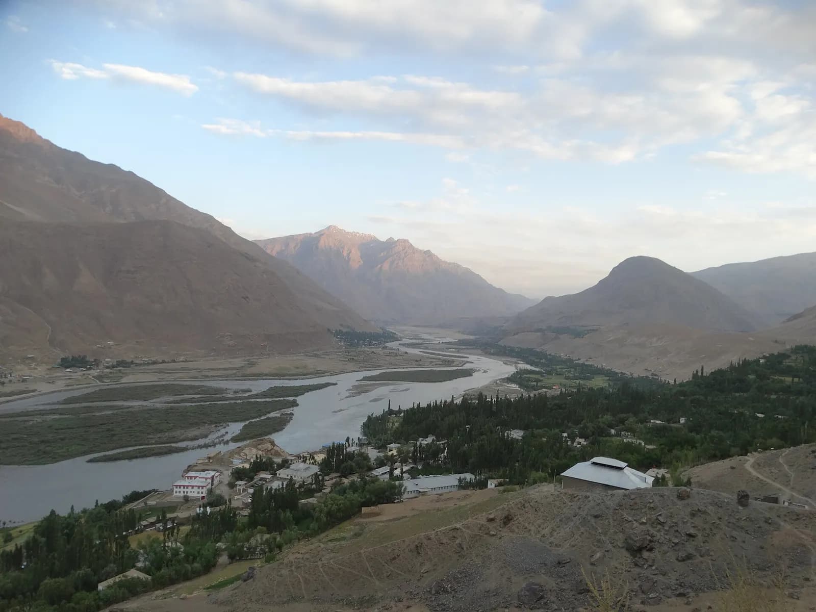
Six to eight hours by four-wheel drive on a rough track east along the Panj, through Wakhi villages and past the side valley at Qazi Deh where Noshaq, Afghanistan's highest peak, shows at its head in clear weather. Lunch around Khandud, the district centre, then on to Qala-e Panja at the meeting of the Wakhan and Pamir rivers. Overnight in a guesthouse.
Day 4Qala-e Panja to Sarhad-e Broghil, 3,300 m
Morning around Qala-e Panja and its old fort, then five to six hours on the track up the Wakhan river to Sarhad-e Broghil, where the road ends. The valley narrows and the Hindu Kush closes in on the south side. Overnight in a Wakhi guesthouse in Sarhad, where the trek crew and pack animals are arranged.
Day 5Trek: Sarhad into the side valleys, about 3,600 m
The first trek day is deliberately short: four to five hours, climbing gradually out of Sarhad into the side valley that leads north towards the pass. Pack animals carry the loads; you carry a day sack. Overnight camping near a herders' summer settlement.
Day 6Trek: up to the high camp, about 3,900 m
Five to six hours on herders' paths through grazing grounds, with stops at Wakhi summer camps where yaks and sheep are brought up for the season. Camp below the pass. The guide checks everyone's oxygen saturation morning and evening from here on.
Day 7Trek: over the pass, about 4,300 m, to the pastures beyond
The hardest day: six to seven hours, with a steady climb to the pass at about 4,300 metres and the Hindu Kush laid out behind you. Down on the far side to the broad pastures at around 4,000 metres that open towards the Little Pamir. Overnight camping; if Kyrgyz herders are grazing this far west, this is where you may meet them.
Day 8Trek: back over the pass to the high camp
A morning in the pastures, then back over the pass to camp below it on the Sarhad side, five to six hours in all. Any member of the group struggling with the altitude descends this way earlier, with a crew member.
Day 9Trek: down to Sarhad-e Broghil, 3,300 m
Five to six hours of descent back to Sarhad, and a night under a roof. Farewell to the herders and pack animals. Overnight in a Wakhi guesthouse.
Day 10Drive Sarhad to Qala-e Panja, 2,800 m
Five to six hours back down the Wakhan by four-wheel drive. Afternoon free to walk in the village and along the river. Overnight in a guesthouse.
Day 11Drive Qala-e Panja to Ishkashim, 2,600 m
Six to eight hours on the track back to Ishkashim, with the Tajik bank of the river and its villages in sight across the Panj for much of the way. Overnight in a guesthouse in Afghan Ishkashim, ready for the morning crossing.
Day 12Cross into Tajikistan and drive to Khorog
Border formalities in the morning, then about two and a half hours north to Khorog, arriving in the afternoon. The trip ends on arrival. Book onward travel from Khorog for the following day at the earliest — the border does not always open on time.
What’s included
- Eleven nights: one hotel night in Khorog, six in village guesthouses or homestays in the Wakhan, and four nights camping on the trek, twin share
- All meals from dinner on day one to lunch on day twelve
- An English-speaking guide throughout and a Wakhi trek crew — cook, herders and pack animals for the loads
- Four-wheel-drive vehicles with local drivers from Khorog to Sarhad-e Broghil and back
- Camping equipment: tents, a mess tent, sleeping mats and cooking gear
- CONFIRM — Afghan tourist permits, Wakhan access permit and registration in Ishkashim and Badakhshan, arranged on your behalf
- CONFIRM — Tajikistan GBAO (Gorno-Badakhshan) permit for the Khorog–Ishkashim road
- CONFIRM — Security escorts or police accompaniment wherever the authorities require them
- CONFIRM — A satellite phone carried by the guide, and a basic medical kit with a pulse oximeter
Not included
- Travel to and from Khorog — from Dushanbe it is a long day by road on the Pamir Highway, or a domestic flight when one operates
- CONFIRM — The Afghan visa, applied for before travel; we provide the supporting letter
- The Tajikistan visa or e-visa, which must allow re-entry from Afghanistan
- Specialist travel insurance valid for Afghanistan, with medical evacuation cover — a condition of booking
- Sleeping bag rated to about minus ten, and personal trekking kit
- Drinks, tips for the guide, drivers and crew, and personal spending
- Extra days or costs caused by a closed border, landslides, changed regulations or an early descent
Good to know
Safety, advisories and insurance
Most Western governments advise against all travel to Afghanistan, including the UK Foreign, Commonwealth & Development Office, the US State Department and the Australian government. That advice covers the whole country, including Badakhshan and the Wakhan. Read your own government's current advice before you book and again before you travel. The Wakhan has been among the quieter parts of Afghanistan, but we will not describe it as safe, and your embassy's ability to help you anywhere in Afghanistan is very limited or absent.
A standard travel policy is void when your government advises against travel. You need specialist high-risk cover valid for Afghanistan that includes medical treatment and evacuation, and we will ask to see the policy before confirming your place. Be realistic about what evacuation means here: from the trek it is days by pack animal and vehicle back to Ishkashim, and the nearest hospital of any standard is across the border in Khorog. Helicopter rescue in the Wakhan should not be assumed to exist.
The situation can change quickly. Departures may be postponed, rerouted or cancelled at short notice — because of a change in the security situation, a new regulation, or the Ishkashim crossing closing. When it happens we will tell you as soon as we know; what is refundable is set out in your booking conditions.
Visas, permits and the Ishkashim crossing
You need three sets of papers. An Afghan visa obtained before travel from a mission of the de facto authorities, the Taliban administration; Afghan permits and registration for the Wakhan, which we arrange; and on the Tajik side a visa that allows you to re-enter Tajikistan from Afghanistan, plus the GBAO permit for Gorno-Badakhshan. The crossing at Ishkashim has opened and closed at different times in recent years, its opening days and hours vary, and the arrangements for foreign visitors change. Everything about access is confirmed for each departure, and nothing is booked on assumption.
Dress, conduct and photography
Women must cover their hair, arms and legs; men should wear long trousers and keep their shoulders covered. The Wakhi are Ismaili Muslims and generally relaxed and hospitable, but the rules of the de facto authorities apply in the Wakhan as everywhere, and restrictions on women's travel and movement have been applied unevenly. If you are a woman considering this trip, talk to us first. Do not photograph officials, checkpoints, soldiers or the border, and ask before photographing anyone. Alcohol is prohibited.
What Challenging / Remote Trek really means
The trek is five days, four to seven hours a day, on herders' paths rather than built trails, with one pass at about 4,300 metres. Pack animals carry the loads. You need to be comfortable walking uphill for six hours at altitude on consecutive days and sleeping in a tent at 4,000 metres in temperatures that can drop below freezing at night, even in August. Headache and broken sleep are normal at first; vomiting, confusion or a headache that will not lift mean descending, and the guide's decision to send someone down is final. The four driving days are long and rough, and for many people they are the harder part.
Season, accommodation and food
June to September is the only window: before June the pass holds snow and the herders have not moved up; by October the nights are bitterly cold. In the villages you sleep in Wakhi guesthouses and homes — mattresses on the floor of a traditional house, shared pit toilets, no hot water to speak of. On the trek you camp. Food is simple: bread, rice, lentils, yoghurt and tea, with whatever the cook can buy.
Money and connectivity
Bring US dollars in clean, recent notes, plus Tajik somoni for Khorog. There are no usable ATMs or card payments in the Wakhan. Mobile coverage is patchy at best beyond Ishkashim and absent on the trek; the guide carries a satellite phone. Tell the people at home that you will be out of contact for most of ten days.
Questions about this trip
Is it safe to travel to Afghanistan?
Most Western governments, including the UK, the US and Australia, advise against all travel to Afghanistan, and that includes the Wakhan. The Wakhan has been one of the quieter parts of the country, but the risks those governments describe apply, consular help is very limited, and you are days from medical care. Standard insurance is void; specialist high-risk cover with evacuation is a condition of booking. Departures can be cancelled at short notice if the situation or the border changes.
Will we reach the Kyrgyz camps of the Little Pamir?
Probably not on this itinerary, and we would rather say so now. The main Kyrgyz camps are five or six days' walk beyond Sarhad, which needs more time than this whole trip. This trek reaches the Wakhi summer pastures and, over a pass of about 4,300 metres, the western margin of the Little Pamir; whether Kyrgyz herders are grazing there depends on the year. A longer version can be planned on request.
How do I get to the start in Khorog?
Khorog is in Tajik Badakhshan. From Dushanbe it is a long day — twelve hours or more — by road along the Pamir Highway, or a short flight when the service operates, which is weather-dependent and irregular. You need a Tajik visa or e-visa that allows re-entry from Afghanistan, and a GBAO permit for the region, which we arrange.
Can I see the forts of Yamchun from the Afghan side?
Yamchun and the Khaakha fort are on the Tajik bank of the Panj, not in Afghanistan. From the Afghan track you look across the river at the Tajik side for much of the way, but picking out a particular fort depends on the light and the angle. On the Afghan side the historic site is Qala-e Panja, where the Wakhan and Pamir rivers meet.
How hard is the trek?
Challenging. Five days of four to seven hours, on herders' paths, with a pass at about 4,300 metres and four nights camping between roughly 3,600 and 4,000 metres. Pack animals carry the loads. You should have done multi-day treks at altitude before, and be ready for long, rough four-wheel-drive days on either side of it.
What happens in an emergency?
The guide carries a satellite phone and a medical kit with a pulse oximeter, and the first response to altitude illness is to descend. Beyond that, honestly: evacuation is by pack animal and vehicle back down the valley, and the nearest proper hospital is in Khorog, across the border. Helicopter rescue should not be counted on, which is why fitness and acclimatisation matter so much here.
Can women and solo travellers join?
Solo travellers are welcome and share a room or tent, or pay a supplement where single rooms exist. Women should talk to us before booking: dress rules apply and restrictions on women's travel have been applied unevenly, so we will tell you what we know for that season. For a shorter, less remote trip, see our Bamiyan and Band-e-Amir cultural tour.
When is the best time to go?
July and August are the most reliable: the pass is clear of snow and the herders are in the high pastures. June and September work too, with colder nights and a chance of early or late snow on the pass. Outside June to September the trek is not possible.
Explore the region
You might also consider
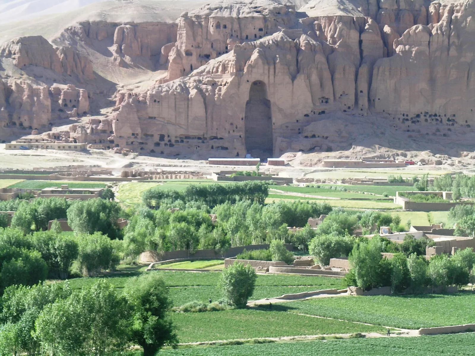
Photograph: Tracy Hunter from Kabul,, Afghanistan (CC BY 2.0), via Wikimedia Commons.
Enquire about this trip
Tell us who is travelling and roughly when. A trip planner — not a call centre — replies within three hours between 9am and 11pm Pakistan time with a day-by-day itinerary and the full price, per person, with nothing hidden underneath it.
- Every itinerary written from scratch around your dates.
- Licensed operator, running these routes since 2020.
- A full costing up front — no deposit to see one.
- +92 310 5344471
- info@elhamasia.com
- 9am – 11pm PKT, seven days a week
- Office No. 227, Rohtas Road, G-9/1, Islamabad, Pakistan


